Showing posts with label puffins. Show all posts

Saturday, August 17, 2013

Newfoundland12 - St John's


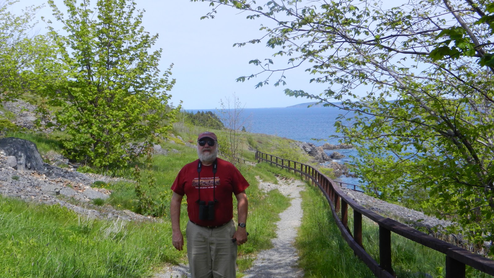
Our next port of call was St John's and the Pippy Park Campground, a very convenient park within the city. We looked at the sky and decided to do Witless Bay and Signal Hill while the sky was clear.  Had we arrived via the long ferry earlier in the month we would have experienced three weeks of fog with a Low spinning offshore.  We signed up with Gatherall's Tour because Molly Baun (smaller and closer) was not in business yet for the season.


As we motored out to Gull Island to see the puffins, we were entertained for 30 minutes or so by two humpback whales (mom and baby). The captain just moves along at about 4 knots and follows them around until they decide they have better things to do than amuse tourists.  

I thought I had seen puffins back at Bonavista and Elliston Point, but, low and behold, a slow ride around Gull Island put us in view of 1000's of puffins and murres.  Puffins use small burrows for their young; murres just put their eggs on the rocks.  When their backs are turned to you, they are hiding their eggs. Flying around were also Black Guillemot and a couple of fulmars (difficult to see among all the other kittiwakes and gulls of all kinds).  Shearwater were not to be seen since they stay at sea unless foggy.  We did see scientists on the island conducting research.
Black-footed Kittiwakes

Atlantic Puffins
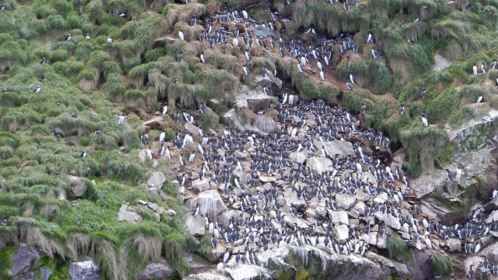
Murres and a few Razorbills

Enroute to Witless Bay, we saw this model harbour just off the road and could not resist taking a picture:


After spending time at the Signal Hill Visitor's Center, we hiked up to Cabot Tower and I logged the Earthcache there.  No wonder this is a good harbour: narrow entrance, excellent lookouts on both sides of the cut and a large, protected harbour.  When we started in Western Newfoundland, the history was of Eskimos, Vikings and European fishermen.  St John's is decidedly Irish.  Lunch at the Celtic Hearth and I had Shepherd's Pie.


The next day after a couple of geocaches in the park, we visited the museum "The Rooms".  The building, glass overlooking the harbour, is as impressive as the exhibits.  This "legacy center" emphasizes those who came before, their hardships and how it affects who they are today.  Notable for me at least are the etchings depicting life in Wesleyville outpost.  Outposts were temporary camps set up by visiting fishermen in the season.  Later, having brought wives and children, they became small villages.  There are still some outposts in existence; but due to concern for their remoteness and the difficulty of adequate social services, most have been relocated to cities.  They are, however, an intergal part of their province history.  We drove out to Quidi Vidi, the closest outpost to St John's.

Quidi Vidi

I had to do one more geocache before leaving St John's, so we searched for one on the way back up the hill to our van.  We searched and searched.  GPS was spinning in circles.  However, on a hunch, I stuck my finger up the end of a steel handrail and there it was.  A little magnet was holding it in place.

View from Signal Hill


Friday, January 25, 2013

Newfoundland10

With just a slight taste of Puffin-sighting, I was ready to go; but before we left, we toured the replica of Matthew, John Cabot's ship which landed at Cape Bonavista in 1497.  Little did I know that John Cabot was actually an Italian sailing under British sponsorship, thus the name change.


Not far from Bonavista, is Elliston Lookout, a geocache site and  puffin colony.  With puffins to watch, we almost forgot about the fact that Elliston is the root cellar capital of the world.  We sat down on the grassy bluff and watched puffins flying around the rocky island just a few feet from our perch.


We were able to find lunch at the Seafarer Inn in Port Union, although there was no fish on the menu.


We drove through Trinity, a restored 19th century community, home to a theatre/art enclave. Driving down the peninsula gave us time to take in what we had seen so far:

100's of puffins, gannets, snow geese, black guillemots, one American Black Duck, murres, eiders to name a few. Then, 20 or so icebergs, 3 moose, 3 foxes and 2 kits, 1 coyote, 1 groundhog, 4 dead porcupine, 1 dead black bear.


We found the Horse Brook Trailer Park just outside Fortune, NFL, run by Bridges Employment Corps, providing job training for multi-challenged. They also operate a tea room in town.  We were their only guests for the night.  We failed to find the Horse Brook geocache, a small camo just off the trail.  Maybe too many muggles in the tourist season.


From there we drove to Grand Banks, found a small tea room/cafe for lunch and then toured the Seaman's Museum, a very nice facility.  This is, after all , the Grand Banks with a commercial fishing harbor. Nearby Fortune actually has a larger harbor and has ferry service to the two French islands offshore.


The Fortune Head Ecological Reserve Interpretation Centre is not large, but does have a good explanation of the 500 million-year-old fossils nearby. The drive out to the Fortune Head Lighthouse and geocache was worth the trip just to talk to the two lighthousekeepers. When the guidebooks say to stop and talk, they really mean it.  We had a pleasant chat before driving the rest of Burin Peninsula counter-clockwise. Burin maybe the name, but barren might be the best description since the day became overcast and windy.


Jack's Pond Campground near Arnold's Cove is a lovely site overlooking Placentia Bay.  We drove up a gravel road to a cleared area with a perfect view of the water. Before long, trailers began to arrive and by nightfall all but 2 of the eight sites were taken. We all were backed in a circle like wagon trains.


Sunday, October 21, 2012

Newfoundland9

After talking to a local lady who had taken an interest in Missy Moo, we moved on to pick up one more geocache at King's Cove Lighthouse.  Not a quick grab, we hiked out to the lighthouse through a grassy meadow, but then we trudged over a partially washed out, suitable-only-for-Jeeps trail.  I thought we might save ourselves by taking an alternate route back - wrong! We had to backtrack to the Roadtrek.


  Up to this point in our trip, we had no problem finding a place for the night. I, however, failed to realize there was no campground in Bonavista; there was one 7 miles out of town, but we didn't want to move on just yet.  A young girl at the Visitor's Center told us to just go out to "the cape" and park  there for the night.  The small, municipal park overlooking the rocky cape was perfect! We were all set to visit the lighthouse the next morning.


 Hiking out across the rocky landscape to find a geocache we were stopped in our tracks while watching a wary lady fox and her two kits who make their home among the rocks near the lighthouse.


I'd been satisfied just seeing the fox and her kits, but on the other side of the lighthouse on a rocky island just offshore we discovered our first puffin.  Maybe hundreds had found a place to burrow and care for their young, but a bit too far for my Nikon Coolpix to get a good picture.  It didn't matter; I was thrilled to see puffins at last!