Wednesday, August 21, 2013

Newfoundland15 - Avalon Peninsula3 - St Mary's Ecological Reserve

Talk about a "natural high", the fossils, the brisk wind, tenacious plant life and a curious seal made this one of the most perfect days ever.  Happy that we took the time to visit the fossil beds, we motored on to St Vincent's where we had heard that whales can often be seen near shore.  We pulled into a parking area with picnic sites next to a rocky beach and started to get out of the van when a fellow camper from Ontario motioned to us to stay put.  He had been watching the whales all day from his motorhome.  Yes, they were that close.  He told us to look for gannet flying overhead because they look for fish.  The whales know that and they follow.  Schools of fish come really close to shore and the whales follow.  This was too good to be true!  We stayed the night.

Whale watching at St Vincent's

The long curved beach with a steep sand and gravel mix provided the opportunity for excellent viewing.  We saw 10-12 humpback whales cruise the shoreline.

We had been fortunate that we had arrived during a period of clear days, so we left the next morning for St Mary's because we knew we wanted to see the gannet colony there.  No need for a guide to take us; we hiked out 1.5 km to the gannet colony.


Atlantic Gannets at St Mary's Ecological Reserve


Murres and kittiwakes


In the second picture taken from the footpath, the middle bluff looks like it sticks out and this is where we walked to and sat down just a few feet from the gannets. Wow!  To our right were the murres and razorbills (black) and some Black-footed Kittiwakes. To gain some perspective, slightly above and to the left of that middle bluff, it looks like it is a bit level and there appears to be some yellow there.  That's where all the people were. I know, you can't see them; but compare that to the size of the bluffs and you can get a sense of what 100's of thousands of gannets look like when they come to Newfoundland to nest.

Knowing we had just experienced a most spectacular sight, we were feeling pretty content and so on day #42 we were ready to leave Newfoundland.  We were not scheduled to leave on the ferry just yet, but we drove to the ferry dock at Argentia and asked if there was room.  No Problem! One week ahead of schedule. but early enough in the season to get a space for the van and a room for the night aboard.  As we enjoyed a buffet dinner, we watched dolphins and whales. Such a nice way to say goodbye to Newfoundland.


Sunday, August 18, 2013

Newfoundland14 - Avalon Peninsula2 - Mistaken Point

Portugal Cove South rest area

We moved our van across the road to a pleasant rest area in full view of Portugal Cove South, a small well-kept village.  While waiting for the tour the next day, we drove on down to Trespassy for lunch and made our way out to yet another lighthouse along a single-lane dirt road which we shared with some local walkers.  I haven't mentioned it, but everyone in Newfoundland is a walker.  With footpaths criss-crossing rocky hills and disappearing into thick pine forests, there are plenty of places to walk.  We even spotted them walking along major highways, miles from anywhere.  Good idea.
The Rookery

A drive and hike out to The Rookery was an introduction to what we were to see at St Mary's Ecological Center later.  These rocky cliffs host 1000's of kittiwakes, murres and gannets.  We were not able to see the puffins up in their burrows, however.  We would have been better with a spotting scope here because of the distance to the cliffs.  The best opportunity was yet to come.

Meanwhile, after a dusty 15-km drive in the National Parks Service van, we hiked out 6.0 km across the barrens, tuckamore, a river and several hills along the old road/path between Long Beach and The Drook communities.  These were among small remote villages set up during the fishing season where young men, eager to meet young women, had to first hike this route to the nearest village of any size, battle other young men for a dance with a pretty lady and then trudge back to fish for yet another day.

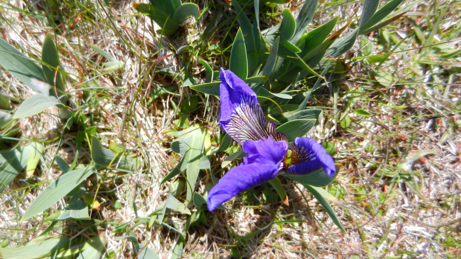
Just looking across the barrens, one might conclude that nothing exists here, but that would be misleading.  The constant wind keeps the plant life very short.  Trees look more like small bushes.  Even irises here are in miniature.  Yet on this barren grow berries that are so vital to migrating birds.  The migrating Whimbrel feeds on the crowberry in August before that 4000-km trip to South America.  Different berries attract different birds and so on.

The path to Mistaken Point


As our Parks guide explained, we had to take off our shoes and don booties because, while we were allowed to walk on the fossils, they were trying minimize our footprint, letting only the wind and sea take its toll.  The fossil beds were created by volcanic eruption 450 million years ago and are the oldest multi-cellular fossils in existence as far as we know now.  By establishing a reserve, not only are the fossils protected, but the barrens are included as well.  After taking photos for an Earthcache, we began to walk back to the van, a much harder walk against a 30-35 kt breeze.


Plants along the path:


Iris, dewberry and crowberry (not yet ready) survive along the path and play their role in the ecology of our planet.


After a day like this, I understand the song of my childhood:  "Oh Lord, My God, when I in awesome wonder, consider all the worlds Thy Hands have made....Then sings my soul..."

Saturday, August 17, 2013

Newfoundland13 - Avalon Peninsula1


With the fog beginning to roll in, I am standing at the eastern-most point at Cape Spear Lighthouse.  Of course we came here to do a geocache, so off we went down a path and literally under the lighthouse.  In the distance, we heard a whale blow three times.  Strategically located, it also was a gun emplacement during WW II for the US.

Yep, it's there somewhere in those rocks! Awesome!

We stopped for lunch at Riverside Restaurant and had a nice conversation with a couple who had driven some schoolchildren down to a fishery nearby.  It just goes to show you that you ought to read carefully before you march off somewhere:  we turned off the highway onto a narrow gravel road and then hiked 0.6 kms across an isthmus to Ferryland Head Lighthouse.  We were joined by two nice ladies from Vancouver who were on their way to pick up a picnic lunch at the lighthouse.  Dang!  Gourmet sandwiches, spring water, fruit and a dessert in a basket, complete with plaid blanket to sit on whilst overlooking the rocky shoreline.  Dang!

Off we trudged to find our geocache, stepping over and around the rocky headland.  Find it we did, but we noticed on our way back up the hill that the picnickers had all but disappeared in the crisp wind.


Ferryland Head Lighthouse


 Sitting out in the harbour was  the iceberg that had floated in two weeks ago.  We had seen a report on the television and you can see a small boat near the 'berg which will give an idea as to its size. As we were walking back to the van, it started to roll.  Ferryland is also the site of the 1620's Colony of Avalon, founded by Lord Baltimore.  Rumor has it that his wife was not impressed and lit off for warmer climes in Maryland. An archaelogical dig is currently working on the site.

Traveling down the Avalon Peninsula starts to get a little sparse as far as settlements are concerned. Our only opportunity for a campsite was Chance Cove Provincial Park, described as having no campsites, but it's okay to stay in the parking lot.  Gettting to it was another deal: 6.0 km toward the coast over a very bumpy gravel road - washboard comes to mind. We thought we might be the only ones here... wrong.  Six travel trailers were permanently set up and a couple more arrived after we did.  Just over a rocky dune, the sound of large pebbles being swept and tumbled by the waves was as calming as a rocking chair.  Numerous trails ran through the pines and across a marsh; some with warnings to stay away from the edges: a fall would mean landing on the rocks below.

Chance?

6 km of gravel road - adventure...

The next day we stopped at the Interpretative Center for Cape Race and Mistaken Point. They weren't open yet so we drove down 20 kms on yet another gravel road to Cape Race Lighthouse and Marconi Station.  This station was the first to hear the Titanic distress signal.  It's an incredible site; the rock ledges uplifted out of the depths of the ocean with rock that began in either Europe or Africa a gazillion million years ago when continents were floating around.  We found our geocache here and left a little something from Indiana.  Back at the Interpretative Center we learned that the guided tours were full for the day so we signed up for the next day.  This site is in the process of becoming a World Heritage Site and as a part of that, locals must be involved in the project.  So, manning the center are locals who seem so delighted that anyone comes to see the fossils at Mistaken Point.  They will tell you that they knew that they were there, but never knew how significant they were.  And the experience is one I will never forget.  Besides that, they told us to just park across the street for the night.